People wonder about the extent of the pond. And we rely on information from USGS Hawaiian Volcano Observatory scientists. One in particular, the late Jim Kauahikaua, was a good friend of mine, and he spent quite a bit of time at the lands north of the airport trying to understand where the boundaries of the pond were. He was a native Hawaiian geophysicist with a PhD and felt, you know, innately connected to Kamehameha and his works.
Reading the Landscape
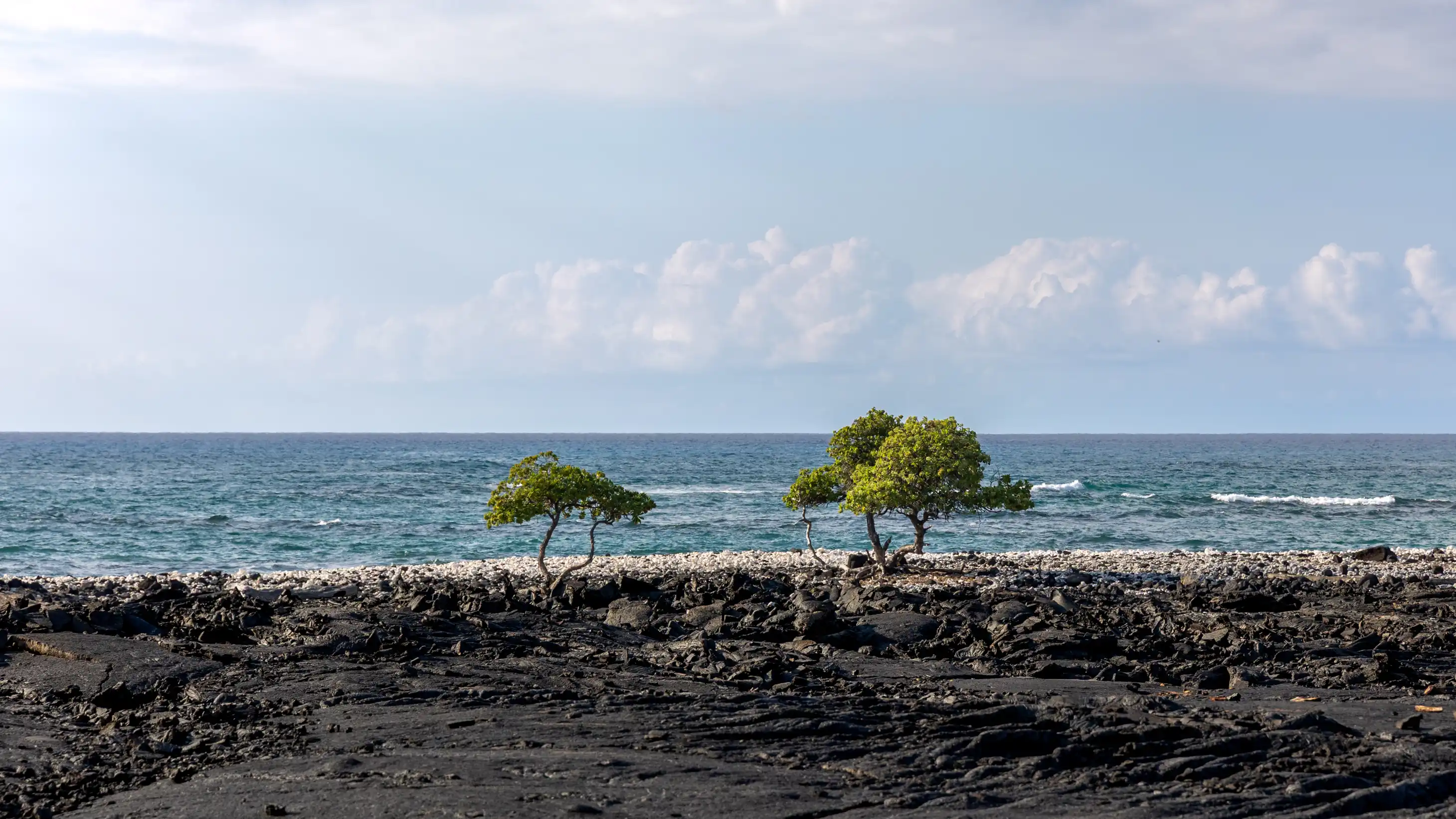
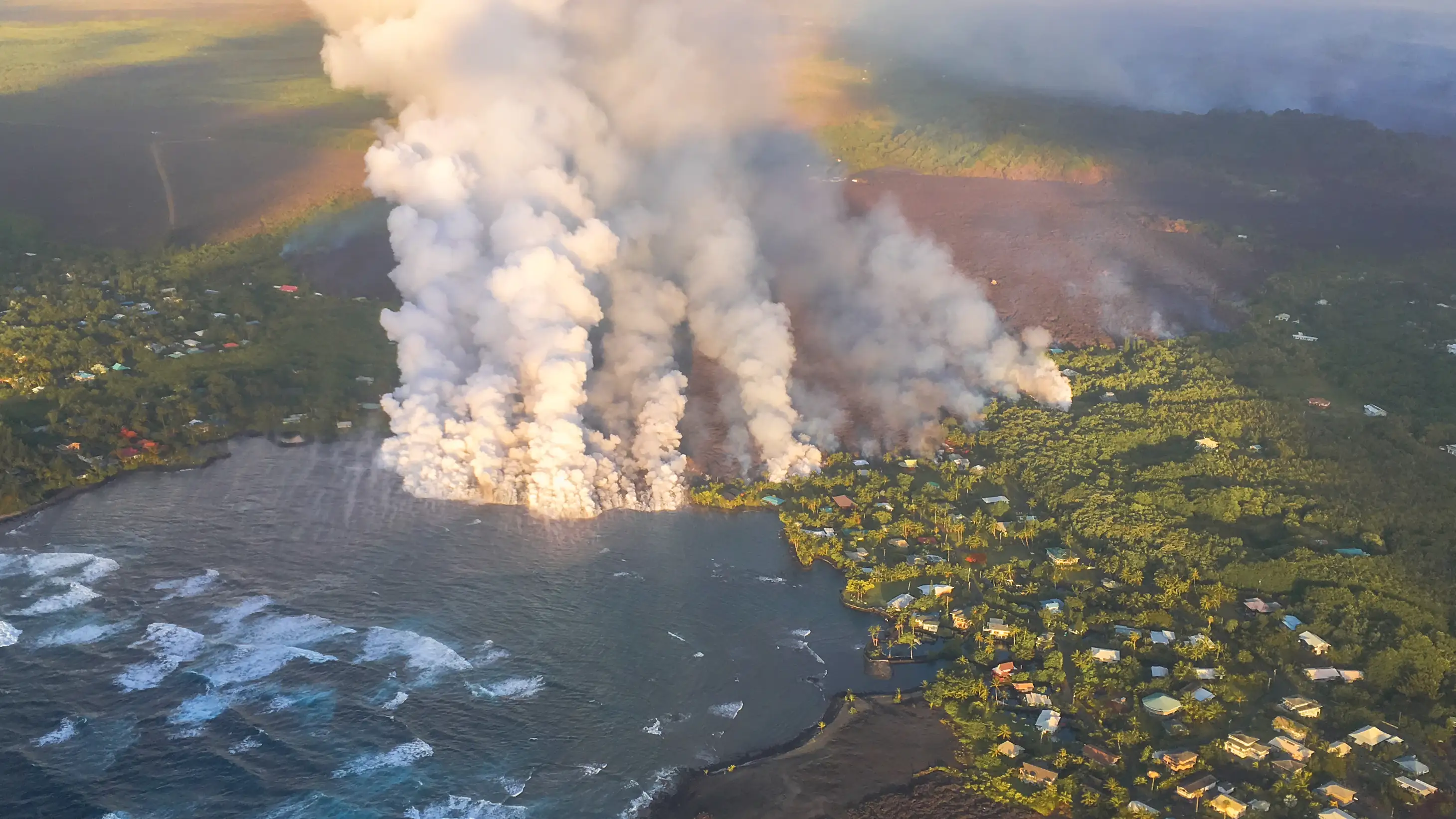
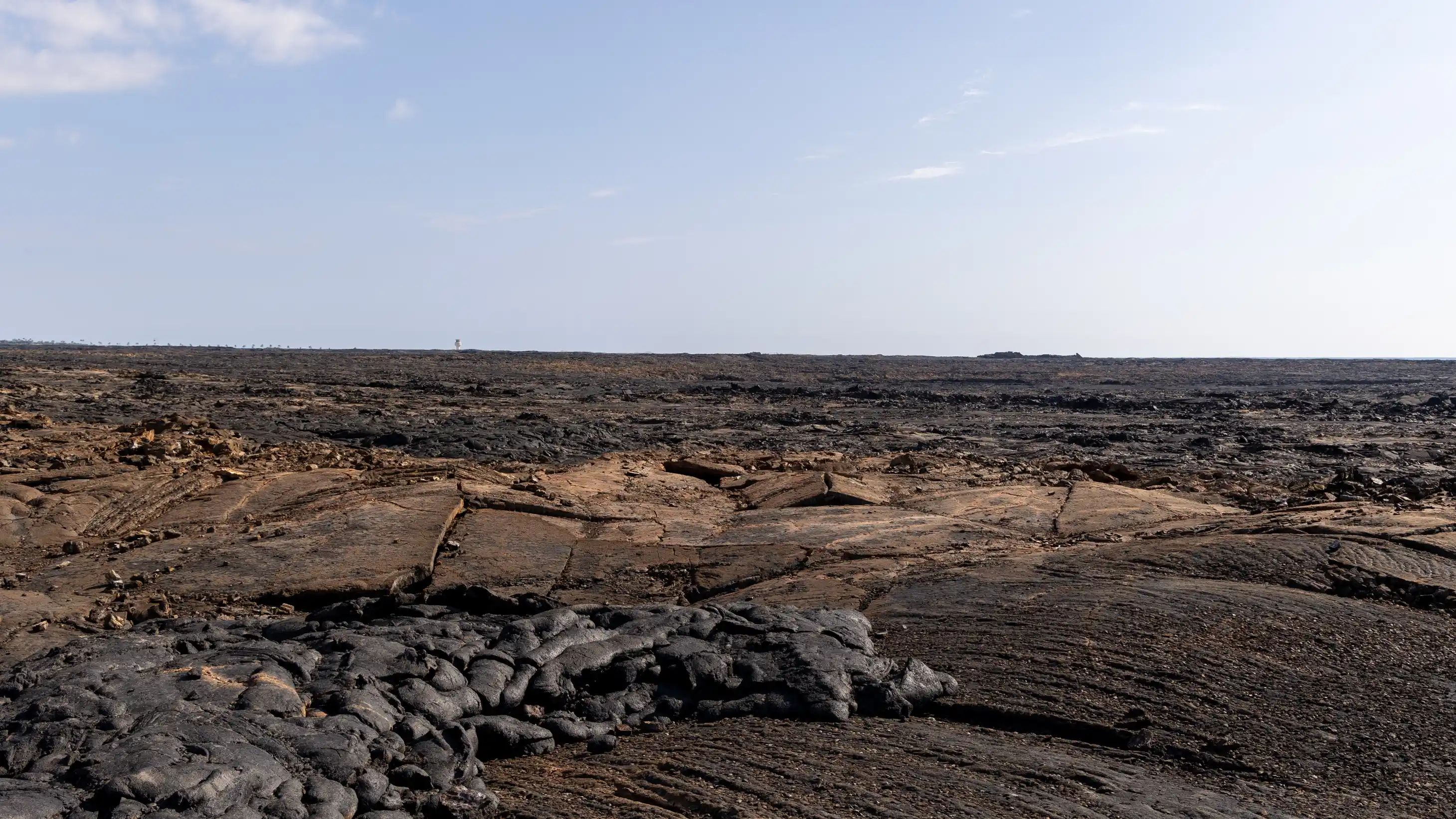
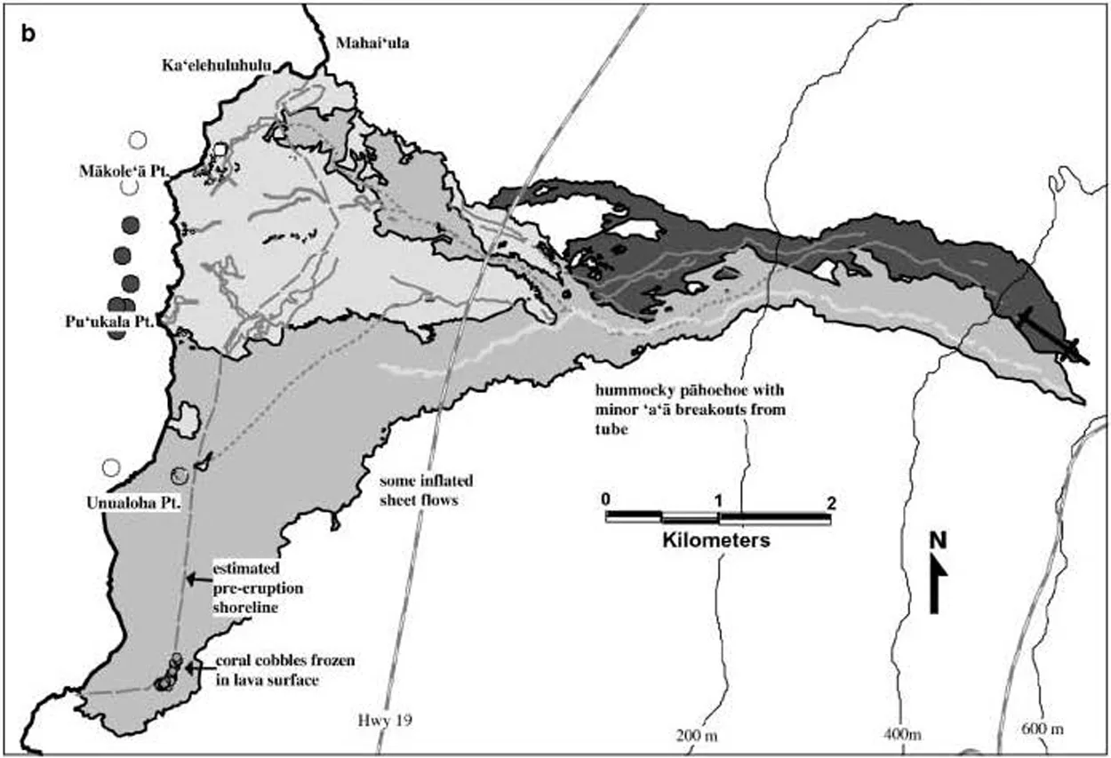
So he looked at the modern landscape. And we know that Keāhole Point is old lava. On the north, we know that Kaʻelehuluhulu is old lava. So how do we connect those two dots? And if you look, especially on the north, two thirds or so, between Keāhole and Kaʻelehuluhulu, you can see that flat area of orange lava. I call it orange, but it's not real orange.
And tracing kind of the outline of that and comparing it with descriptions saying that the pond was three miles wide and a half mile, or even a mile and a half, deep. We're not talking deep; we're talking about the mauka or inland extent from the shore. That probably is generous.
The Canoe Route
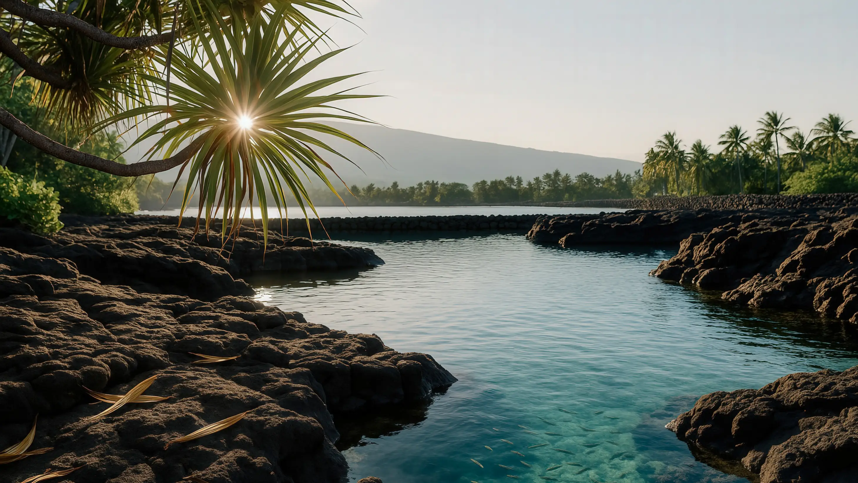
But, you know, today we can measure whatever the distance is from Keāhole to Kaʻelehuluhulu, but you don't want just a straight line because it would've been an embayment like this. And to get through the pond via canoe, which is how people travel that coast, they would go through the pond because, as I said, the waters off of Keāhole are very, very deep. And Keāhole is a place where the north current and the south current come, and they meet there.
"It's like the surface of the ocean was jumping... It's like all these little sharp wavelets were popping up. And it was where the two currents were meeting."
And I was fortunate enough to be out there in a boat one time, and the captain was telling us, "Watch, now look, look at the water. We're getting close." And it's like the surface of the ocean was jumping like that. It's like all these little sharp wavelets were popping up. And it was where the two currents were meeting. It was fascinating.
The Protected Waters
And so that indicates deep, deep water, strong current from the north, strong current from the south. And then in this eddy along the shore, the embayment would've been a lot calmer. And it would've been easier for a canoe to go in through maybe a mākāhā on the north end or, you know, maybe there just was an opening at that end before walls started being built. And then paddle southward and then come out on the south side.
"There's some things that we'll never know."
We don't have a lot of information about that, unfortunately. We just don't know. But, you know, surmising is all we can do based on what we understand of the dimensions. I mean, the pond couldn't have gone into the old lava because we'd see evidence of that. And so this is the area that we have to work with.
And the drawing in the report that I helped Jim with has the theoretical edge of the fish pond. And we won't know, but you know, it's okay. There's some things that we'll never know.