Hualālai, Pāʻaiea, and the Shaping of Kona’s Coast
The island of Hawaiʻi, youngest in the archipelago, is formed by five separate, sometimes interfingered volcanoes: Kohala, Maunakea, Hualālai, Maunaloa, and Kīlauea. All are visible above sea level. Two additional volcanoes lie underwater. Māhukona is west of Kohala, and Kamaʻehuakanaloa is off the southeast coast.
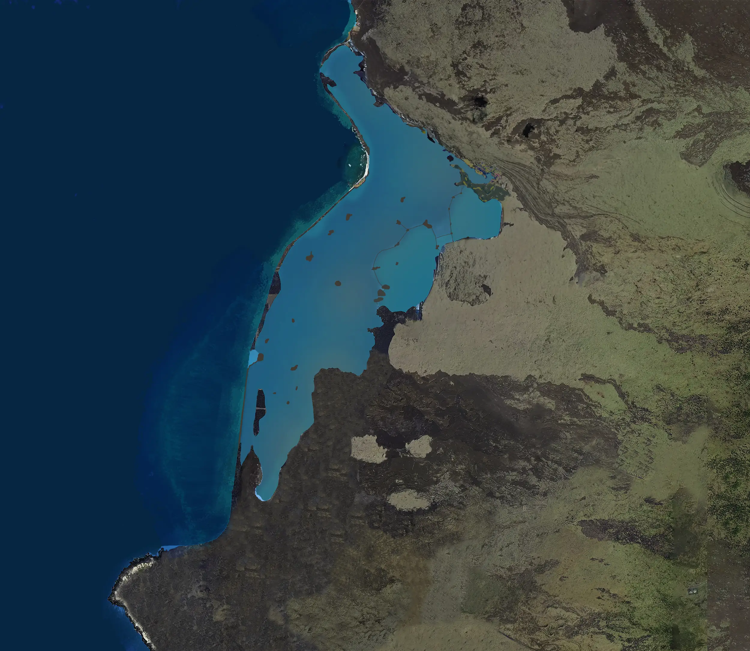
Hualālai forms the island’s western promontory and is intermediate in age. It last erupted in 1800 and again in 1801. The 1801 event began at the bottom of Kīleo, a cinder cone at Huʻehuʻe just ma uka of Māmalahoa Highway near the 2,000 foot elevation. Shortly after the initial outbreak, magma migrated underground about half a mile ma kai, erupted, and lava flows eventually reached the ocean.
The island’s relative geological youth is evident in vast tracts of fresh-appearing lava. One of the most recent flows from Hualālai filled an extensive fishpond, Pāʻaiea, which had been constructed by Native Hawaiians under the stewardship of Kamehameha. This pond was located just north of where the Ellison Onizuka Kona International Airport at Keāhole stands today.
Ma uka of Keāhole and Queen Kaʻahumanu Highway, slightly older lava flows cover the land. Much of this area is now overgrown by highly invasive fountain grass (Cenchrus setaceus), introduced as an ornamental plant just over a century ago. These flows range from roughly 2,100 to 6,000 years old, and their leading edges were buried by the 1801 flow, which complicates efforts to discern the boundaries of the fishpond.
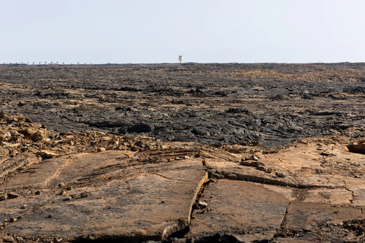
One helpful clue in locating the edges of Pāʻaiea is the way molten lava reacts with water. When 2000°F lava enters fresh or saltwater, the water boils and steams. This interaction oxidizes iron in the lava, causing it to have an orange tint, especially around cracks. As long as these rust-tinted flows have not been buried by subsequent eruptions, mapping the areas of orange coloration can help identify the extent of the fishpond.
Other evidence may include deposits of tephra, black sand, and rock, which exploded at the ocean margins of the flow. Mapping these deposits may also help confirm the fishpond’s location.
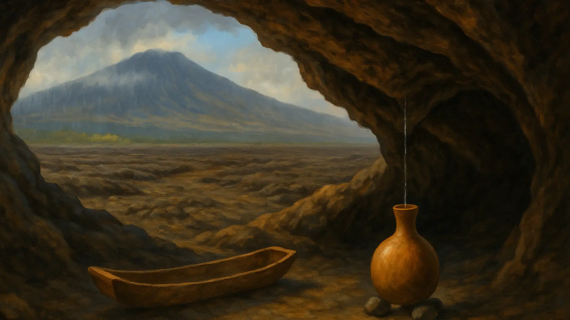
Lava Tubes: Where Water Drips and People Rest
A feature of pāhoehoe (smooth lava) flows are lava tubes. They form when streams of molten lava crust over, insulating the interior and allowing lava to remain hot and flow farther. In the case of the 1801 eruption of Hualālai, the distance from vent to ocean is about five miles, and at the shore, lava continued to flow underwater, adding bulk to our island.
Lava tubes evolve during an eruption, eroding into pre-existing ground and widening. When activity ends, much of the molten lava in a tube continues to flow, causing the tube to slowly empty. Weak places in the ceiling may collapse, forming skylights that can allow relatively easy entry to the interior.
Caves (emptied lava tubes) serve many purposes in Hawaiʻi. Their cool, shady interiors allow travelers to rest when traversing arid lands. Perhaps their most important characteristic is that they can provide drinking water in seemingly waterless lands like Kekahawaiʻole o Kona (waterless Kekaha of Kona). In a land lacking fresh water streams, but having an abundance of pāhoehoe and ʻaʻā (smooth and rough lava), pāhoehoe is able to transport water from wet mountain slopes to desert coasts, as water moves through vesicles (pores) in countless layers of lava. Water drips from ceilings of caves, even in Hawaiʻi deserts. Water can be collected in wood troughs, similar to a canoe, by placing the vessel under productive drips. More commonly, empty gourds—propped level by a little tripod of pebbles and positioned under the dripping ceiling—would fill and supply those in need.
Cool, damp cave interiors served as locations for plaiting hala (Pandanus) mats and other items. Humidity keeps strands pliable as theyʻre being woven.
Temporary habitation could be had in caves with a minimum investment in resources. Sleeping or work areas, cleared of loose stones, might be softened with layers of mats, and the interior lit by kukui nut torches or stone lamps holding wicks of kapa (barkcloth) in kukui oil.
Some caves served as burial places, where bodies or bone bundles of the dead were interred. While individual skylights (access points) were named, entire cave systems were not. Itʻs thought by some that cave segments holding burials between skylights are kapu, while other segments of the same lava tube are not.
Interior walls of lava tubes are often glazed with thin, fragile layers of smooth lava. Working with a pointed stone, petroglyphs were delicately pecked through the veneer of cave walls. While we may not know or understand the symbology, petroglyphs may offer clues to lifeways and former practices of residents.
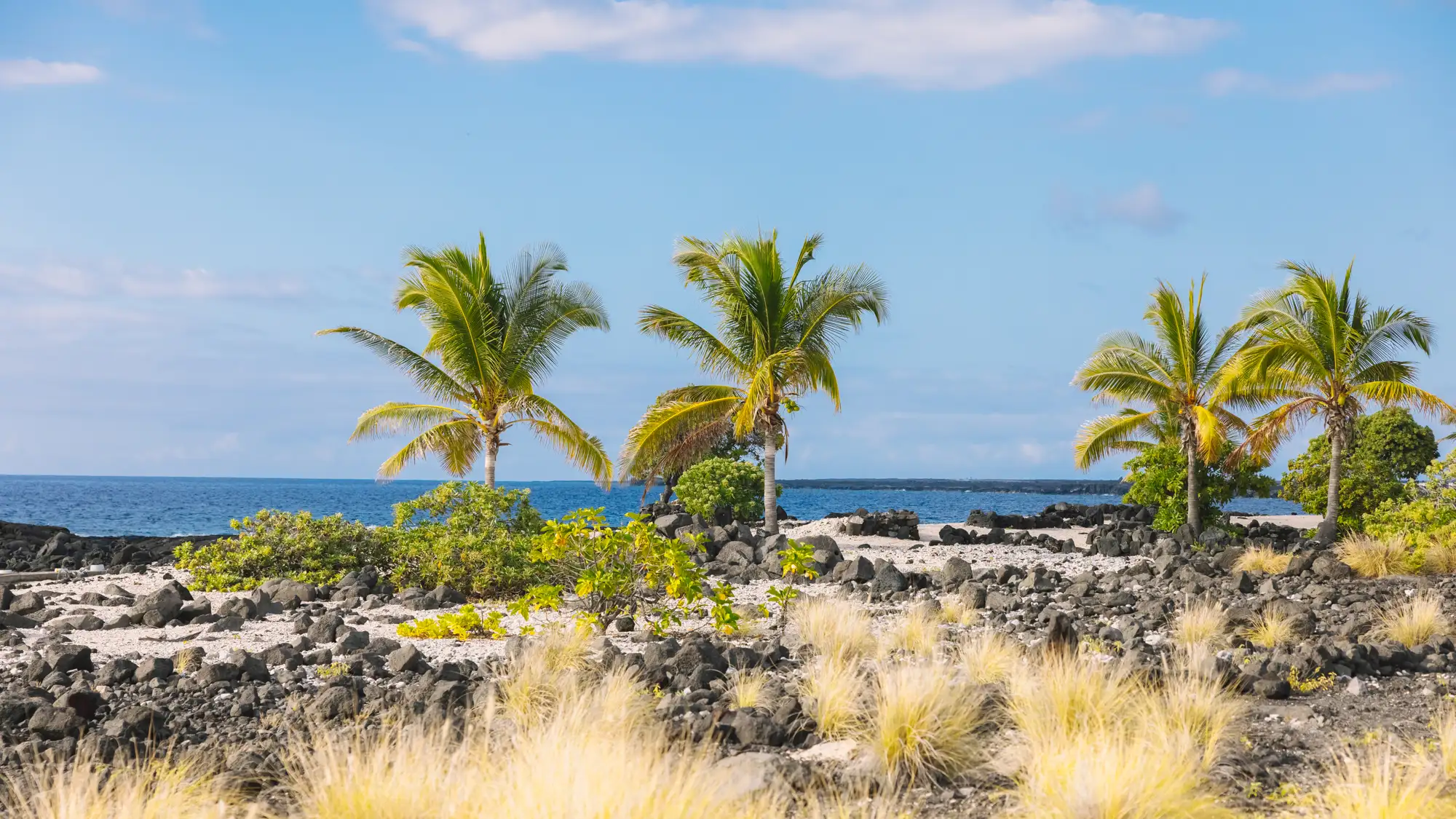
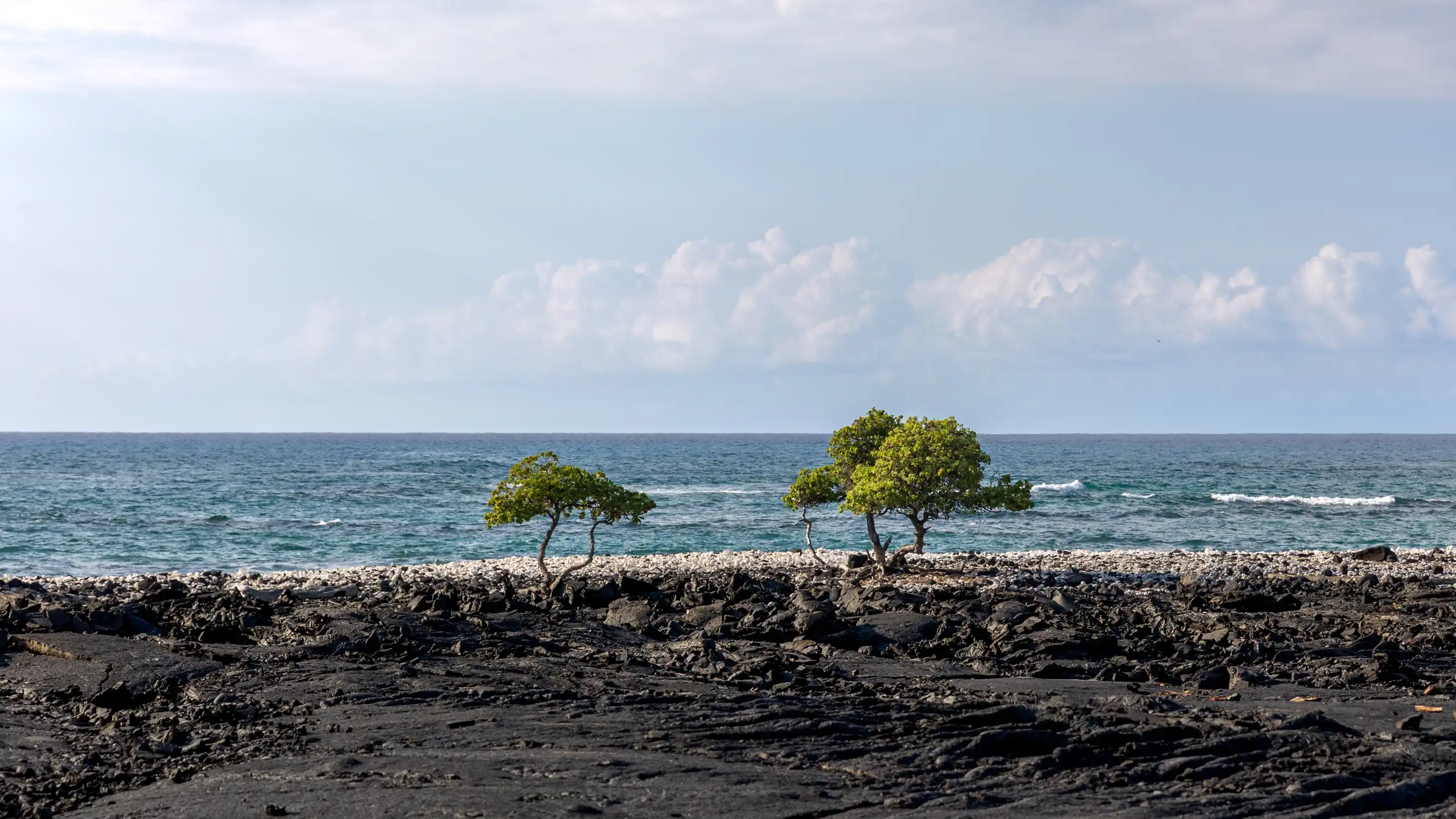
This coastal stretch near Hoʻonā reflects the dry, windswept character of Kekaha, a region settled later in Hawaiian history due to its harsh conditions. Despite the lack of streams, early communities developed innovative ways to thrive here. Read more on An Archaeological and Cultural Review and Assessment of the Ho‘onā Historic Preserve within the NELHA Host Park.
The Arrival and Adaptation of Life
Volcanic islands in the midst of a vast ocean… How did propagules (seeds, stems, spores, fruit, etc.) get here? There have been islands in more or less our location for tens of millions of years. Volcanoes, layer upon layer of lava, slowly built upward and finally surfaced. Over millennia, life of both sea and land made their way here. Most did not survive their hazardous journey, but the few successful introductions managed to find homes here and thrive.
Everything, everything that made it to Hawaiʻi on their own we call Native. Native plants, animals, and people. All survived voyages of thousands of miles on wing, wind, and wave. The people who trace their ancestries in Hawaiʻi to the times before Captain Cook arrived are todayʻs Kānaka ʻŌiwi, Native Hawaiians. Multiple voyages on double-hull sailing canoes between Hawaiʻi and Kahiki, an ancestral homeland, brought settlers to our shores. Some trips proved unsuccessful. But once here, navigators understood how to return to recruit more potential residents by utilizing star compasses, winds, swell patterns, and the flight paths of birds.
Current ideas shared by anthropologists tell us that the extremes of the Polynesian Triangle (Aotearoa, Rapa Nui, and Hawaiʻi) were all settled between about 1200 and 1275 CE during voyages from Central Polynesia. Knowing the diversity of habitats in Hawaiʻi, ranging from rain forest to desert, from sandy beaches to alpine mountains, from atolls to our Northwest to active volcanoes on Maui and Hawaiʻi, The First Ones wouldʻve likely explored before selecting their homebase.
On windward coasts, freshwater streams and springs, an abundance of trees for fuel and building material, intact reef and deepsea ecosystems, as well as populations of various large flightless birds wouldʻve sustained people until agricultural crops and farmed animals could be harvested.
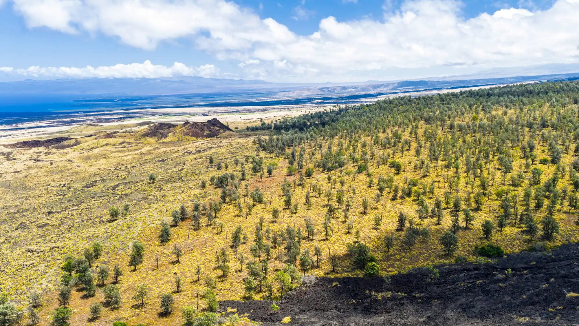
The expansive ʻāina pōhaku (rocklands) of the island of Hawaiʻi was likely settled later, as population increases made living on marginal lands necessary. Ingenious methods of farming seabirds, and growing ʻuala and kalo in mulched rock mounds were developed to increase food productivity. Rocky fields were cleared by building stone walls, and gardening was practiced to superb levels.
The Rust Tells the Story
You can still see the orange lava. That rust-colored oxidation shows where the lava flowed through the fishpond water, with steam causing the iron in the lava to oxidize. And that black sand layer, that's tephra—exploded fragments from where the lava entered the ocean at the pond's edge. All those little clues help us find where the fishpond used to be, even though the lava covered it.